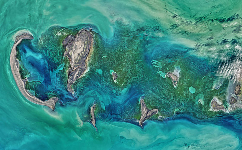
The Operational Land Imager (OLI) on NASA’s Landsat 8 satellite acquired this large natural-color image showing a view of the Caspian Sea around the Tyuleniy Archipelago on April 16, 2016. Ocean scientist Norman Kuring of NASA’s Goddard Space Flight Center found a puzzling feature in the image — lines crisscrossing the North Caspian Sea. On its own, the image was strikingly beautiful. Shallow waters surrounding the Tyuleniy Archipelago allow you to see the dark green vegetation on the sea bottom.Captions and Photo source: NASA image by Norman Kuring, NASA’s Ocean Color web
Excerpts;
The Caspian Sea is the Earth’s largest inland body of water. It lies at the junction of Europe and Asia, with the Caucasus Mountains to the west and the steppes of Central Asia to the east. It is bordered by Russia to the northwest, Azerbaijan to the west, Iran to the south, Turkmenistan to the southeast and Kazakhstan to the northeast.
Despite its name, the Caspian Sea can be called either a lake or a sea. It has historically been considered a sea because of its size and its saline water, but it embodies many characteristics of lakes.
The question of whether it is a lake or a sea has political and economic ramifications. If the Caspian Sea is a lake, then the United Nations and international law have no control over its waters. If it is a sea, international organizations can have input on its use…


