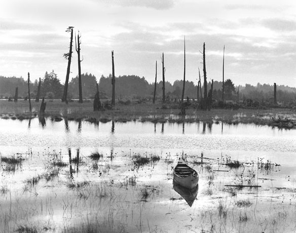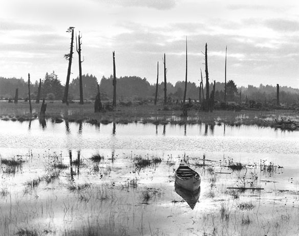
This “ghost forest” near the mouth of the Copalis River, Washington, was killed by saltwater tides after an earthquake in 1700 caused the land to subside. Photograph taken by Brian Atwater. Captions and Photo source: Soundwaves / USGS
Excerpts;
Though some 20,000 people perished or are considered missing after Japan’s massive earthquake and tsunami last year, the toll in human lives could have been far worse, one researcher says, noting that a similar event occurring in the U.S. Pacific Northwest could be far more deadly.
The magnitude 9.0 earthquake that struck Japan on March 11, 2011, was the largest known quake to strike the seismically active country, still, some 90 percent of the coastal region’s residents and visitors evacuated effectively, said Patrick Corcoran, an Oregon State University education and outreach specialist, who just returned from a disaster symposium at United Nations University in Japan. That figure is a testament to Japan’s earthquake planning and drills, as the tsunami had the potential to kill some 200,000 people.
The same situation would likely play out differently in the Pacific Northwest, Corcoran said, because the area isn’t as prepared as Japan was.
“Our human nature is not tuned in to long-term threats and 300-year-cycle disasters,” Corcoran said in a statement. “It takes a big cultural shift to go from not thinking about an earthquake and tsunami to really and truly expecting one.”
That is the kind of planning the Pacific Northwest needs to consider,” Corcoran said. “It isn’t economically feasible to immediately shift our hospitals and nursing homes. But over a period of years or decades, when new facilities are being considered, preference might be given to sites at high elevations.”
Corcoran’s tips: Identify areas of high ground near your home, work and recreation areas. Work to make them accessible.
Read Full Article, Our Amazing Planet
“Psyched for the full-rip nine,” Outside Online, blogpost
Pity poor Cassandra, blessed by Apollo with the power of prophecy, cursed with the fate of disbelief. She tells the people what’s coming. She suffers their laughter, absorbs their scorn. Then she watches her prediction come true. Yeah, you told us so, they’ll say as they bury the dead…
Patrick Corcoran feels her pain. It’s his job. Every day, he rises at dawn and goes out into the world to tell people to prepare to meet their doom. Or, rather, to prepare to escape it. Corcoran is a professional geographer in Astoria, Oregon, a misty fishing port where the Columbia River meets the Pacific Ocean. He’s a high-energy guy, 50, with a little Billy Bob Thornton to his look. Loves his job and loves his coffee. Drives around in his Toyota Tacoma all day with an 11.5-foot-long Takayama paddleboard strapped to the rack. He’s a coastal natural-hazards specialist with Oregon Sea Grant, a marine version of an agricultural extension service affiliated with Oregon State University…”
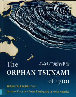
The Orphan Tsunami of 1700:Japanese Clues to a Parent Earthquake in North America: USGS
Prepared in cooperation with the Geological Survey of Japan (National Institute of Advanced Industrial Science and Technology), the University of Tokyo, and the University of Washington.
Published in association with University of Washington Press.

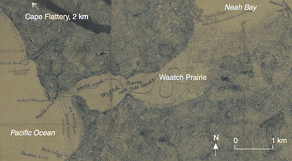
“Old writting from Cascadia offer few hints that subduction zone produces great earthquakes or tsunamis. Such events are unknown from the records of early explorere like Bruno de Hezeta y Dudagoifia, who mapped the mouth of Washington’s Quinaults river in 1775. The oral traditions of Cascadia’s native peoples, however tell of flooding from the sea. (see James Swan’s Diary, 1864, at neah Bay, Washington, home of the Makah Tribe.) Swan’s informant, Billy Balch, was a Makah leader. Balch recounts a sea flood in the not very remote past. It began by submerging the lowland between Neah Bay and the Pacici Ocean. next, the water receded for four days. Rising again without any swell, the sea covered all but the highest ground on both sides of the Syrait of Juan de Fuca. It dispersed tribes, strandes canoes in trees, and caused numerous deaths…” Captions and Photo source: PUBS/ USGS
By USGS,
One winter’s night in the year 1700, a mysterious tsunami flooded fields and washed away houses in Japan. It arrived without the warning that a nearby earthquake usually provides. Samurai, merchants, and villagers recorded the event, but nearly three centuries would pass before discoveries in North America revealed the tsunami’s source.
The Orphan Tsunami of 1700 tells this scientific detective story through clues from both sides of the Pacific. The evidence uncovered tells of a catastrophe, a century before Lewis and Clark, that now helps guide preparations for future earthquakes and tsunamis in the United States and Canada. – USGS
The Orphan Tsunami of 1700 – Japanese Clues to a Parent Earthquake in North America, Pdf File, USGS
Abstract:
“The outside world scarcely knew of northwestern North America in the year 1700. The Pacific coast, from southcentral Alaska to Oregon’s Cape Blanco, was uncharted until the Spanish and English explorations of the 1770s.
Yet, when tectonic plates suddenly shifted there in 1700, a train of ocean waves, a tsunami, sped across the Pacific Ocean. When the waves came ashore in Japan, they flooded fields and washed away houses. Samurai, merchants, and villagers recorded the mysterious event, but they observed no storm and felt no parent earthquake.
In Japan, this tsunami was an orphan.

The Orphan Tsunami of 1700 tells this transpacific detective story by presenting its primary sources, Japanese documents and North American sediments and tree rings. They tell of a catastrophe a century before Lewis and Clark’s expedition that now guides preparations for future earthquakes and tsunamis in the North Pacific.
A rich array of graphic detail and narrative explains the creation, action, and lasting effects of earthquakes and tsunamis.
Brian F. Atwater is a geologist with the U.S. Geological Survey and an affiliate professor of earth sciences at the University of Washington. Satoko Musumi-Rokkaku teaches at Obirin University, Tokyo. Kenji Satake is deputy director of the Active Fault Research Center for the Geological Survey of Japan. Yoshinobu Tsuji is associate professor at the Earthquake Research Institute, University of Tokyo. Kazue Ueda is retired from the Earthquake Research Institute, University of Tokyo. David K. Yamaguchi is a statistician at the Center for Health Studies, Group Health Cooperative, Seattle.
“Paddling around the salt marshes and tidal flats of Washington State, Atwater discovered evidence of earthquakes and giant waves of a magnitude that seemed, to many, inconceivable, until late last year, when a tsunami of similar power tore across the Indian Ocean, killing more than 200,000.” – Time Magazine, naming Brian Atwater one of the world’s 100 most influential people of 2005.”


