The Arctic’s ‘last bastion’ of sea ice is breaking up for the first time on record
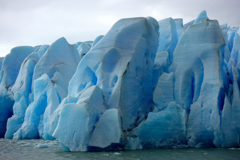
The sea ice off the coast of northern Greenland is normally some of the thickest in the entire Arctic, with ridges of ice piled as high as 70 feet in some places. But recent satellite imagery shows that some of the Arctic’s oldest ice has been replaced by miles of open water for the first time on record, surprising scientists and ice monitors.
USGS Responds to Hurricane Lane
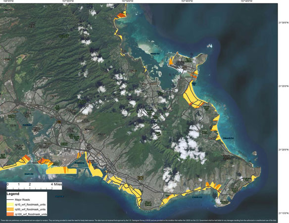
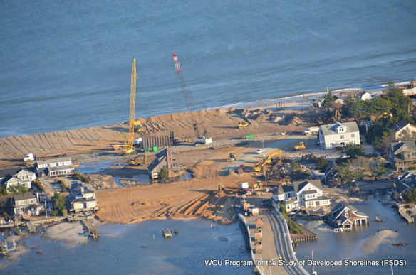
USGS deployed 44 instruments off the coast of the Hawaiian island of Molokaʻi as part of an experiment on a coral reef-lined shoreline. There is also a camera system on shore measuring wave-driven run-up and flooding. It is the largest-ever project looking at waves, wave-driven flooding and coastal change. The data collected before, during and after Hurricane Lane will improve the basic understanding of coastal change processes.
Before and After the Kerala Floods
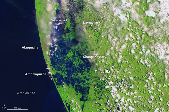
Swollen rivers have altered the landscape in India’s state of Kerala. Residents in India’s state of Kerala are reeling from a “once-in-a-century” flood that displaced nearly a million people.
Hurricane Lane: Category 2 storm bringing “catastrophic flooding” to Hawaii
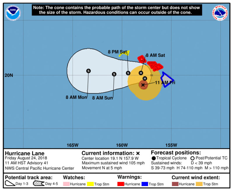
The Category 2 storm was expected to turn west on Saturday before reaching the islands and skirting Oahu — the state’s most populated island. Even without making a direct hit, forecasters said the system threatened to bring a huge storm surge, high wind and heavy rain.
Tracking Sargassum’s ocean path could help predict coastal inundation events
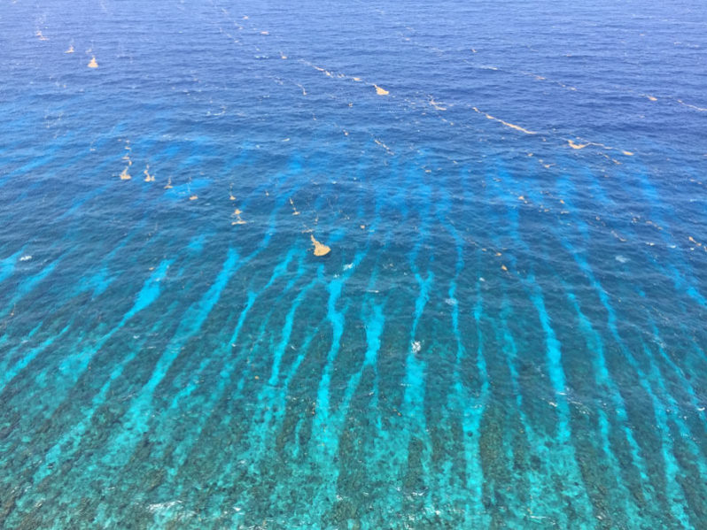
New research explores how the Sargassum might grow while it is meandering along the currents, not just where it floats, combining both ocean physics and seaweed biology for the first time to understand the distribution patterns. Knowing could eventually help predict its arrival and impact on beaches around the world
Can We Outbuild Future Coastal Flooding?
Klaus Jacob, a disaster and risk management scientist at Columbia University’s Lamont-Doherty Earth Observatory, and Western Carolina University coastal geologist Rob Young, discuss different strategies for managing the storms and flood waters of the future. A Podcast.
Hawaii’s Biggest Hurricane Threat in More Than Two Decades
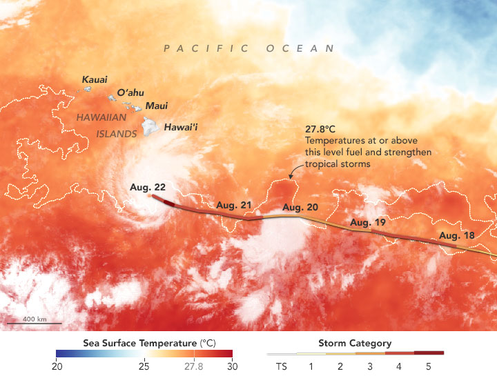
Lane just weakened to a Category 4 storm on Wednesday, but the hurricane still has winds of up to 155 miles an hour and remains the most powerful hurricane to threaten Hawaii in more than two decades.
Sea level rise is already eroding home values, unbeknownst to their owners
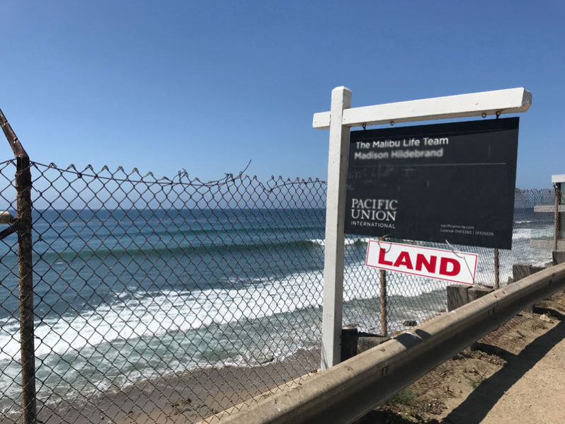
Three studies have found evidence that the threat of higher seas is also undermining coastal property values, as home buyers – particularly investors – begin the retreat to higher ground.
Muddy waters: Exploring mangrove governance in Tanzania
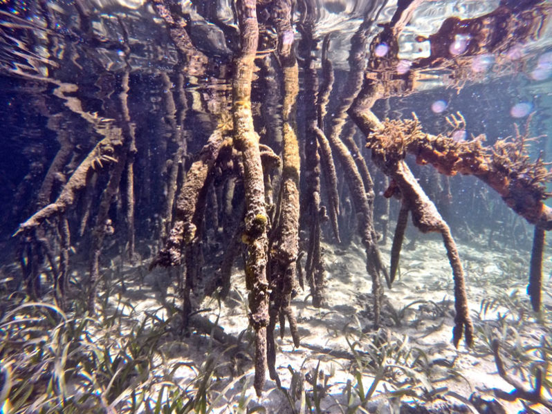
At the Global Landscapes Forum (GLF) in Nairobi later this month, a side event devoted specifically to mangrove preservation and restoration around the African continent’s coastlines will attract a range of stakeholders offering an opportunity to review lessons learned from research undertaken in the Rufiji Delta and mangrove ecosystems across the globe.