The wild horses of the Outer Banks won’t evacuate. They have a special trick to survive hurricanes
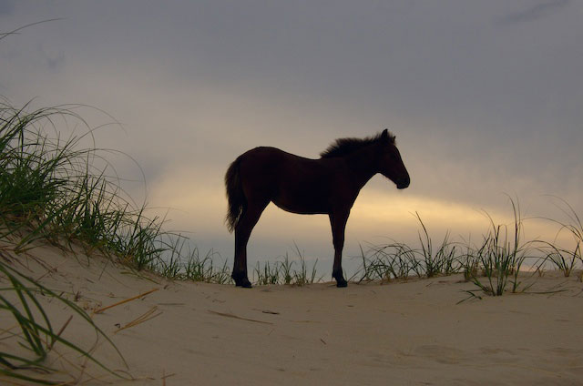
A bunch of majestic horses that spend their days frolicking on the beach in North Carolina’s Outer Banks will not be evacuated. They will move to higher ground and gather under sturdy oak trees to shelter.
“Everything is gone”: Hurricane Dorian survivors share stories of survival in the Bahamas
Aboard the HC-144 cargo plane, the devastation is clear. The fragile islands were no match for Dorian’s Category 5 fury and the landscape looks like a bomb site.
Live Update: Hurricane Dorian threatens the US east Coast after devastating the Bahamas
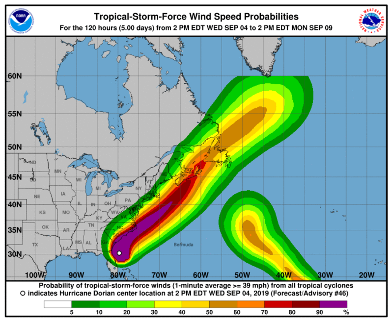
Where’s Dorian? It’s off Florida’s east coast, moving north. It could reach the coasts of the Carolinas later in the week. Track the storm here.
Hurricane Dorian moving up East Coast after leaving Bahamas in ruins
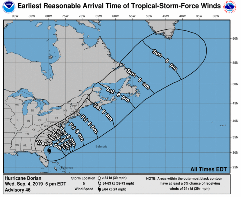
While Florida didn’t get the brunt of the storm, as the storm slowly moved north up the East Coast, North Carolina and South Carolina were bracing for a direct hit. Dorian could still potentially make landfall Thursday or Friday.
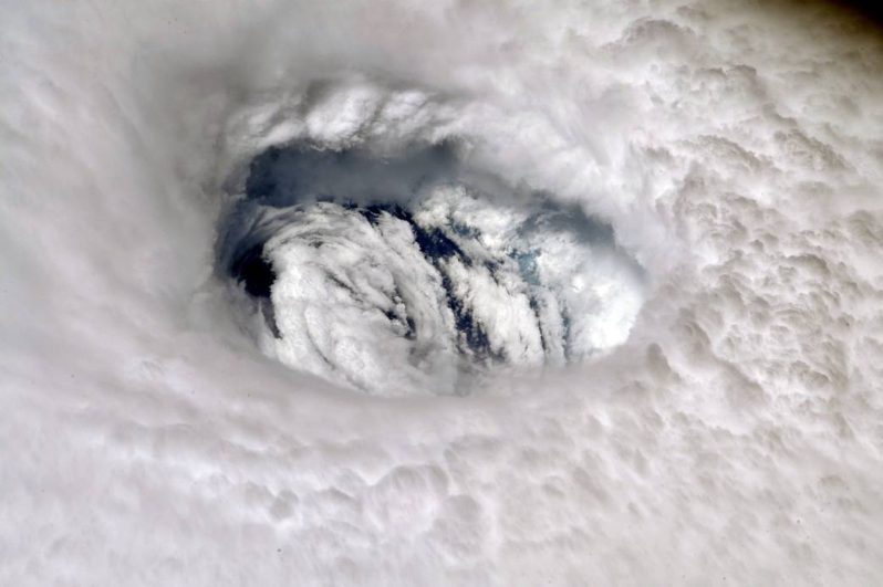
A Devastating Stall by Hurricane Dorian
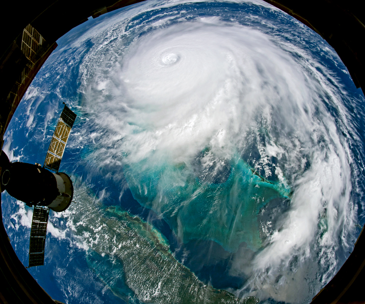
The second strongest Atlantic hurricane in modern meteorological records stalled over Grand Bahama, the northernmost of the Bahama Islands. When Dorian finally began drifting north, it left a wake of catastrophic damage in the Bahamas. Preliminary assessments indicated that nearly 70 percent of homes were underwater at some point. The Red Cross reported roughly 13,000 homes were destroyed or severely damaged.
The only airport on Grand Bahama is wiped out, severely hampering aid to Hurricane Dorian victims
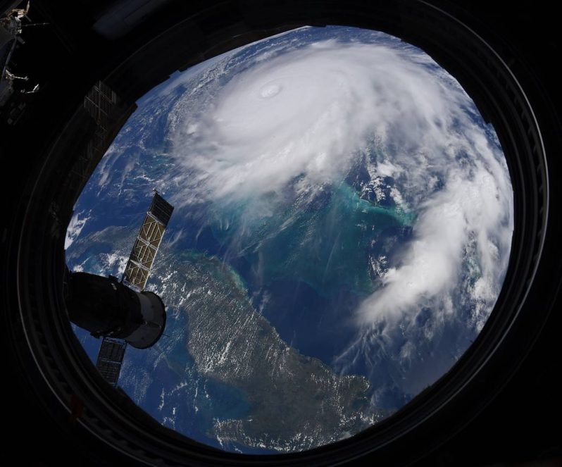
Across the northern Bahamas, what used to be stunning islands are now scenes of widespread destruction. Hurricane Dorian pulverized the islands for two days, hurling catastrophic winds and relentless rain. It was the strongest storm ever to make landfall in the country.
NASA’s ARIA Team Maps Flooding in the Bahamas
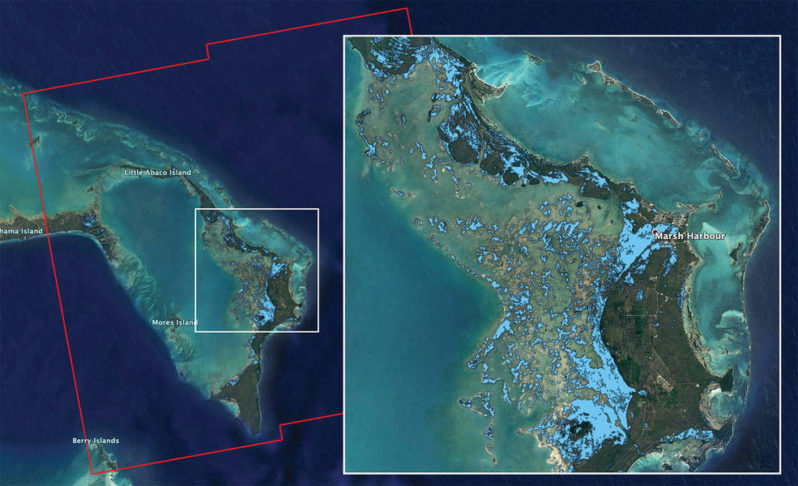
The map covers an area of about 109 miles by 106 miles (176 kilometers by 170 kilometers) shown by the large red polygon. Each pixel measures about 32 yards (30 meters) across. Authorities and responders can use flood maps like this one as guidance to identify areas that are likely experiencing flooding
The end of the world’s most famous beaches – II ; By Orrin H. Pilkey and J. Andrew G. Cooper

In celebration of Coastal Care’s 10 Year Anniversary, we are republishing an acclaimed selection of the most popular Beach Of the Month contributions of the decade.
Great Barrier Reef health outlook downgraded to “very poor” due to ocean warming
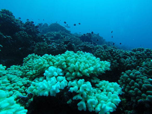
The government agency that manages Australia’s Great Barrier Reef has downgraded its outlook for the corals’ condition from “poor” to “very poor” due to warming oceans.