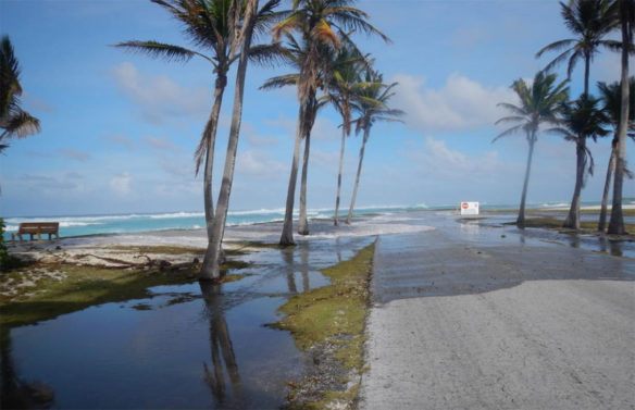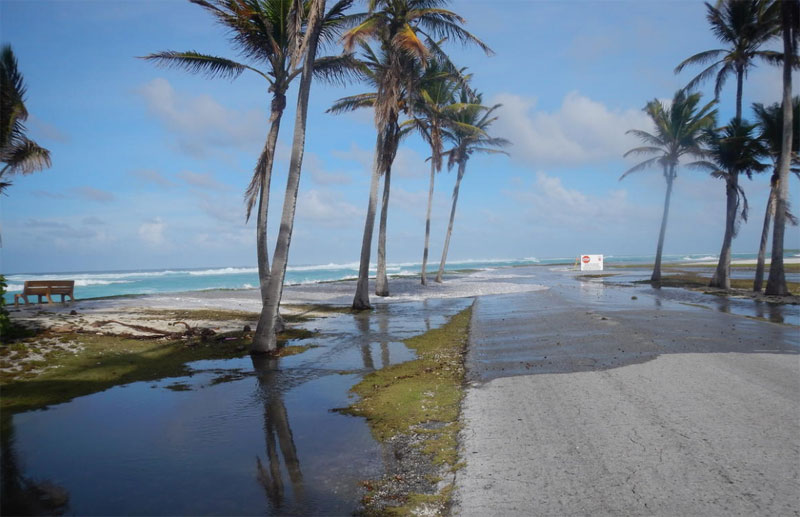
Wave-driven flooding and overwash on Roi-Namur Atoll, Republic of the Marshall Islands(Credit: Peter Swarzenski , U.S. Geological Survey. Public domain.)
USGS;
The frequency and severity of coastal flooding throughout the world will increase rapidly and eventually double in frequency over the coming decades even with only moderate amounts of sea level rise, according to a new study released in “Scientific Reports.”
This increase in flooding will be greatest and most damaging in tropical regions, impairing the economies of coastal cities and the habitability of low-lying Pacific island nations. Many of the world’s largest populated low-lying deltas (such as the Ganges, Indus, Yangtze, Mekong and Irrawaddy Rivers), also fall in or near this affected tropical region.
The new report from scientists at the U.S. Geological Survey, the University of Illinois at Chicago and the University of Hawaii shows that with just 10 to 20 cm (4 to 8 inches) of sea level rise expected no later than 2050, coastal flooding will more than double. This dramatic increase in coastal flooding results from rising sea levels combined with storm-driven flooding, including the effects of waves and storm surge.
In most coastal regions, the amount of sea level rise occurring over years to decades is small, yet even gradual sea level rise can rapidly increase the frequency and severity of coastal flooding. Until now, global-scale estimates of increased coastal flooding due to sea level rise have not considered elevated water levels due to waves, and thus have underestimated the potential impact.
The researchers combined sea level projections with wave, tide and storm surge models to estimate increases in coastal flooding around the globe. They found that regions with smaller variations in ocean water levels due to tides, waves and storm surge, common in the tropics, will experience the largest increases in flooding frequency.
“Although it is commonly understood that sea level rise will increase the frequency of coastal flooding, most of that previous scientific work has focused on analyzing tide gauges which capture extreme tides and storm surge, but not wave-driven water levels. Tide gauge data exist only for a limited number of locations around the world. Using models rather than individual tide gauges provides a comprehensive picture of the widespread vulnerability rather than at sparse points where observed data exist,” said lead author of the study, Sean Vitousek, who was a post-doctoral fellow at the USGS when he began this study. Vitousek is now a professor in the Department of Civil & Materials Engineering at the University of Illinois at Chicago.
“The key findings are that areas with limited water-level variability, due to small tidal ranges (for example, the Tropics), and more limited ranges in storm water levels (such as the North American West Coast), will experience the largest increases in flooding frequency. In the Tropics, today’s 50-year water level event will occur every 5 years with just 10 cm of sea level rise,” said USGS geologist and coauthor, Patrick Barnard.
Most previous research has started with expected scenarios of sea level rise and attempted to find the flooding frequency increase. In this new study, the scientists took the opposite approach, finding the amount of sea level rise needed to double the frequency of flooding, while accounting for the uncertainty and year-to-year variability of storm patterns. One of the surprising findings was that it does not take much sea level rise to double the frequency of flooding (particularly in the Tropics). Using this analysis, Vitousek and his coauthors demonstrate that 10 cm or less of sea level rise expected within the next few decades, can more than double the frequency of coastal flooding for many locations across the globe. The areas with smaller increases in flood frequency include areas with very large tidal ranges and those along typical tropical storm paths.
“Most of the world’s tropical atoll islands are on average only 1-2 meters above present sea level, and even in the high tropical islands such as Hawaii, Guam, American Samoa, U.S. Virgin Islands, Indonesia, and others, the majority of the population and critical infrastructure is located on a narrow coastal fringe at low elevations (1-2 m above present sea level) and thus susceptible to this increased flood frequency,” said USGS geologist and coauthor, Curt Storlazzi.
“These important findings will inform our climate adaptation efforts at all levels of government in Hawaii and other U.S. affiliated Pacific islands,” said coauthor Chip Fletcher, Associate Dean and Professor at the School of Ocean and Earth Science and Technology at the University of Hawaii.
The full report, “Doubling of coastal flooding frequency within decades due to sea-level rise,” is published online in Science Reports.


