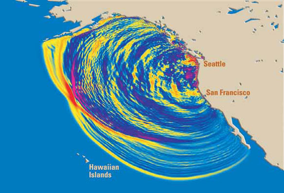
In this computer simulation, tsunami waves are radiating outward after a magnitude (M) 9 earthquake that occurred on the Cascadia Subduction Zone offshore of northern California, Oregon, and Washington on January 26, 1700. This view shows the waves 4 hours after the quake. Colors indicate wave heights—red is highest. Along parts of the coast of the Pacific Northwest, 30-foot-high (9 m) waves rushed inland. Within 20 hours the tsunami did damage throughout the Pacific, and it is well documented in written records from Japan. For more information: Orphan tsunami. Captions and Image source: USGS
Excerpts;
Bracing for a tsunami like the one that devastated Japanese communities during a 2011 mega-earthquake, coastal communities from British Columbia to California have been grappling with how to protect people from a similar catastrophe…
Rising Above the Risk: America’s First Tsunami Refuge, Science Daily (10-21-2014)
Are We Wiser About Tsunamis?, Science Daily (09-23-2015)
More People Could Survive Tsunami If They Walk Faster, ABC News (04-15-2015)


