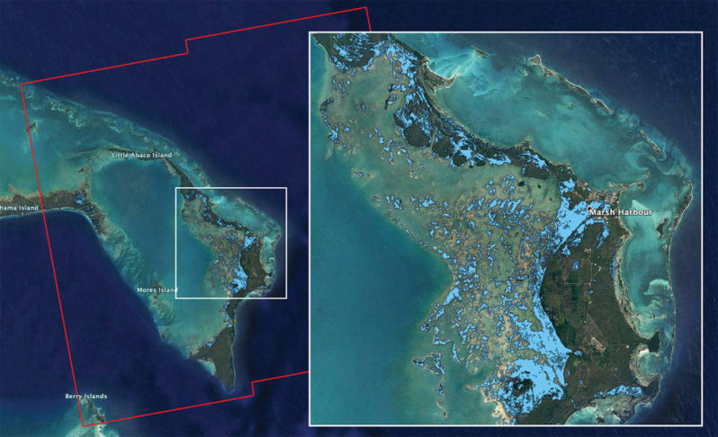
NASA’s ARIA Team Maps Flooding in the Bahamas

The map covers an area of about 109 miles by 106 miles (176 kilometers by 170 kilometers) shown by the large red polygon. Each pixel measures about 32 yards (30 meters) across. Authorities and responders can use flood maps like this one as guidance to identify areas that are likely experiencing flooding
