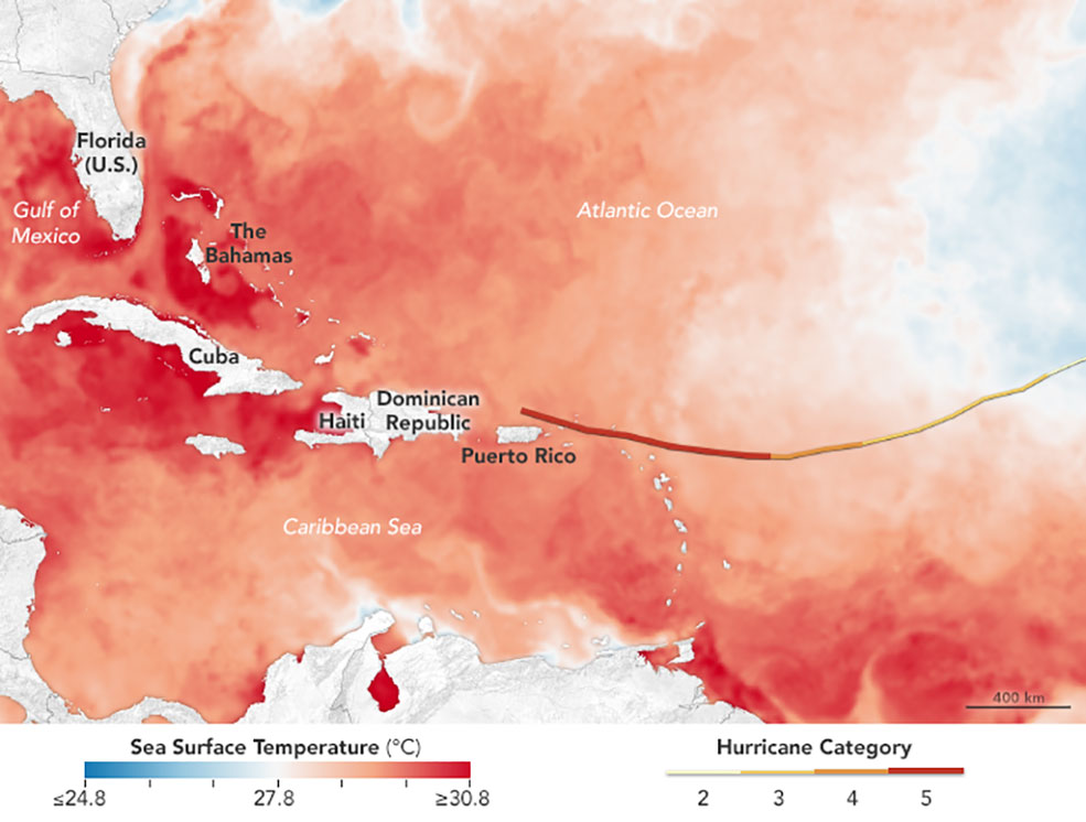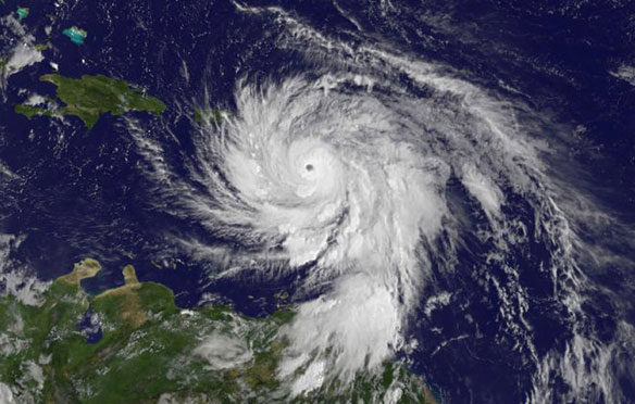
The map above shows sea surface temperatures in the Atlantic Ocean, Caribbean Sea, and Gulf of Mexico on September 5, 2017. As the category 5 storm approaches the Bahamas and Florida in the coming days, it will be passing over waters that are warmer than 30 degrees Celsius (86 degrees Fahrenheit)—hot enough to sustain a category 5 storm. Warm oceans, along with low wind shear, are two key ingredients that fuel and sustain hurricanes. Image source: NASA
Excerpts;
Irma, dubbed the most powerful Atlantic storm in a decade, had maximum sustained winds of 170 mph on Thursday afternoon as it moved further away from the northern coast of Puerto Rico and over the Dominican Republic and Haiti…
Read Full Article; ABC News (09-07-2017)
Hot Water Ahead for Hurricane Irma; NASA / Earth Observatory (09-07-2017)
By definition, category 5 storms deliver maximum sustained winds of at least 157 miles (252 kilometers) per hour. When it hit the Leeward Islands, Irma’s winds surpassed 185 miles (295 kilometers) per hour, making it the strongest storm to ever hit the islands and one of the strongest storms ever measured in the Atlantic basin…

