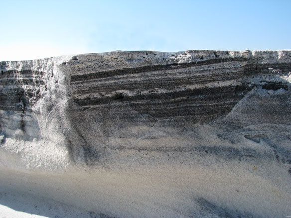
Oiled sediment. This photo shows the swash zone at USGS sampling location MS-39 on East Ship Island, MS. Waves have cut a steep section into the sand, revealing alternating layers of clean and sticky organic-rich sand that are visible after low tide. (The swash zone is the zone that is alternately covered and exposed by waves.) Captions and Photo source: Shane Stocks / USGS
Excerpts;
A new Florida State University study is investigating how quickly the Deepwater Horizon oil carried into Gulf of Mexico beach sands is being degraded by the sands’ natural microbial communities, and whether native oil-eating bacteria that wash ashore with the crude are helping or hindering that process…


